 Breitbart
 By BOB PRICE
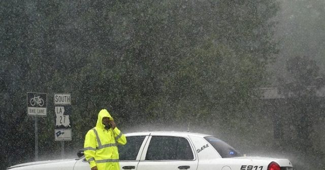
National Weather Service officials called Hurricane Laura’s expected storm surge “unsurvivable.” The category 4 could push a storm surge as high as 15-20 feet onto the western Louisiana coast and up to 15 feet on the far eastern Texas coast. The surge could go inland as far as 40 miles in some areas, officials warned.
The 4 p.m. CDT weather advisory from the National Hurricane Center warns that Hurricane Laura could cause a “Unsurvivable storm surge with large and destructive waves will cause catastrophic damage from Sea Rim State Park, Texas, to Intracoastal City, Louisiana, including Calcasieu and Sabine Lakes. This surge could penetrate up to 40 miles inland from the immediate coastline, and flood waters will not fully recede for several days after the storm.”
The National Hurricane Center has forecasted "unsurvivable storm surge" from Hurricane #Laura in parts of Louisiana and Texas. Do NOT underestimate this storm.
This is what that kind of water height looks like: pic.twitter.com/ik7EtpFTzn
— The Weather Channel (@weatherchannel) August 26, 2020
At last report, Hurricane Laura’s center is located about 155 miles south of Lake Charles, Louisiana, and 155 miles South Southeast of Port Arthur, Texas. It is currently moving to the northwest (320 degrees) at about 15 miles per hour, officials reported.
National Hurricane Center (NHC) Director Ken Graham told reporters the storm is expected to pose a “life-threatening situation,” Yahoo News reported. The news outlet reports coastal flooding can already be seen in parts of the southwestern Louisiana coastline.
The strongest storm surges are expected to occur to the right (east) of the storm’s center as it approached the coastline and begins to move onshore.
A look at the Holly Beach area a little earlier. #HurricaneLaura #lawx pic.twitter.com/2BUbVk1iak
— Brian Emfinger (@brianemfinger) August 26, 2020
The NHC reported sustained winds near the center of the hurricane have reached 145 mph. While the storm is currently moving to the northwest, it is expected to make a turn to north-northwest and then to north sometime tonight. The point of impact for the eye of Hurricane Laura will depend on when that turn begins. The northward path is expected to continue through Thursday and the storm should begin to turn to the northeast Thursday night or early Friday morning.
Tropical-storm-force winds are expected to cover most of western Louisiana to about 100 miles into eastern Texas. The tropical storm winds could reach all the way into southern Arkansas, models show. These winds are expected to be felt in southeast Texas and southwest Louisiana by 8 p.m. CDT on Wednesday.
“The power of [Hurricane Laura] is deadly, and Texans must take action now to get out of harm’s way,” Texas Governor Greg Abbott warned in a Twitter message. “The conditions of this storm are unsurvivable, Texans in the path of the storm are urged to evacuate immediately.”
Louisiana must take Hurricane Laura seriously. Make sure your plans are in place, that you have what you need and that you evacuate if you need to before it's too late. #lagov #Laura #HurricaneLaura #Lawx pic.twitter.com/jUoAd3D3mw
— Gov. John Bel Edwards (@LouisianaGov) August 26, 2020
Louisiana Governor John Bel Edwards warned residents of his state to take Hurricane Laura’s threat seriously.
Louisiana must take Hurricane Laura seriously. Make sure your plans are in place, that you have what you need and that you evacuate if you need to before it's too late. #lagov #Laura #HurricaneLaura #Lawx pic.twitter.com/jUoAd3D3mw
— Gov. John Bel Edwards (@LouisianaGov) August 26, 2020
“Little time remains to protect life and property before water levels begin to rise and winds increase in the warning areas,” National Hurricane Center officials tweeted on Wednesday afternoon.
1 PM CDT: #Laura is now an extremely dangerous category 4 hurricane with maximum winds of 140 MPH. Little time remains to protect life and property before water levels begin to rise and winds increase in the warning areas https://t.co/tW4KeFW0gB pic.twitter.com/6f9tvionaR
— National Hurricane Center (@NHC_Atlantic) August 26, 2020
Border / Cartel ChroniclesPre-ViralFEMAGreg AbbottJohn Bel EdwardsNational Hurricane CenterNational Weather Service
Outer Bands of #HurricaneLaura in New Orleans, LA. #hurricane @weatherchannel @wunderground @breakingweather @accuweather @cnnbrk @CNNweather #Louisiana pic.twitter.com/tgPckFU3DD
— Jonathon Wasserman (@j6wass) August 26, 2020