 Военное обозрение
 By Topwar
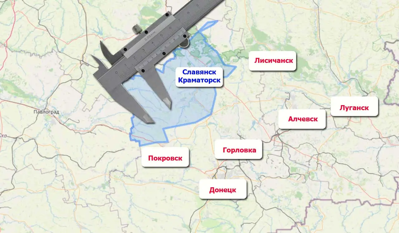
The approximate area of enemy-controlled territory in the Donetsk People’s Republic has been calculated. This includes areas from Redkozub and Svyatogorsk in the north to Belitske and the outskirts of Rodynske (including the Mirnohrad pocket) to the southwest.
According to estimates, approximately 4700 square kilometers remain under the occupation of the Ukrainian armed forces as of December 9, 2025.
Considering that the total area of the DPR within the borders of the former Donetsk region is 26517 square kilometers, it turns out that at the moment the enemy still controls 17,72% of the republic’s territory.
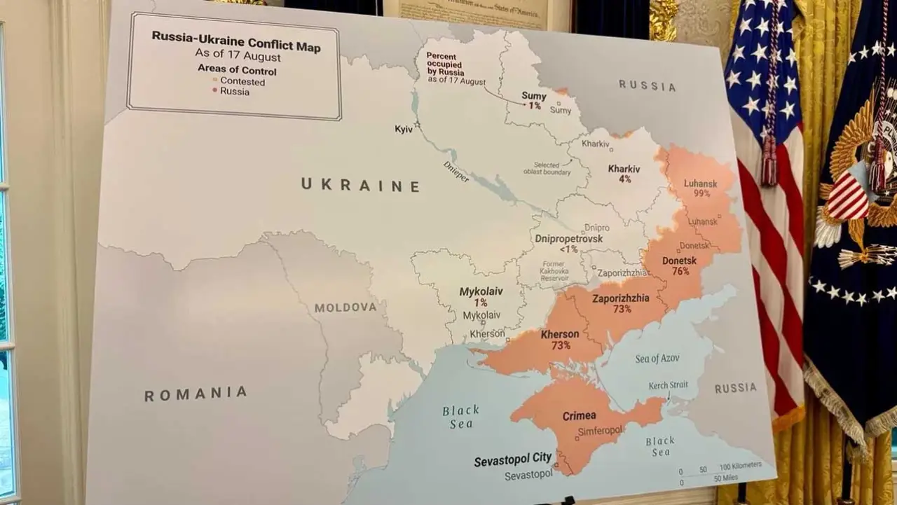
Let’s recall that this is what the map looked like when Trump and Zelensky discussed it at the White House on August 17, 2025:
…
Read Full Article Here…(en.topwar.ru)
Home | Caravan to Midnight (zutalk.com)
Live Stream + Chat (zutalk.com)


Be First to Comment