
Ash emissions increasing
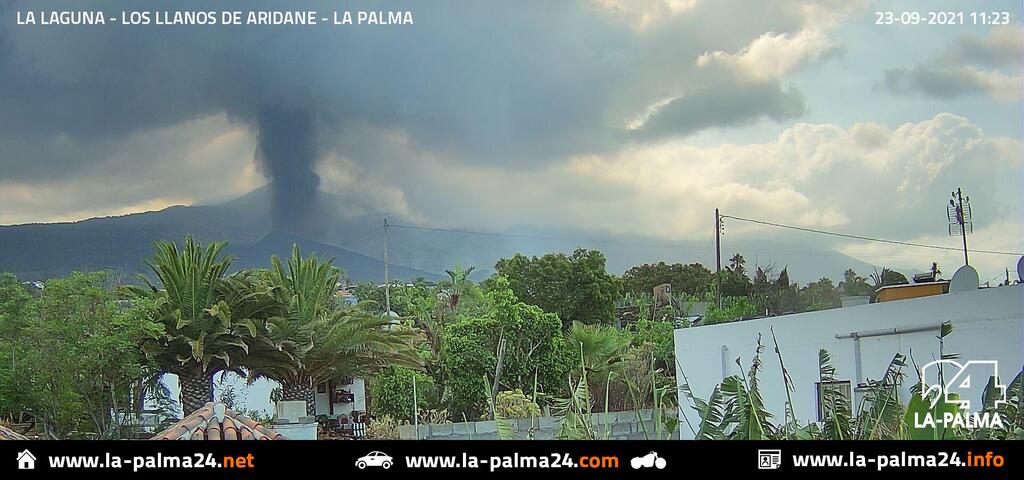

The eruption has been becoming “ashier”; today, the plume has been reaching 4000 m and is visible from much of the island.
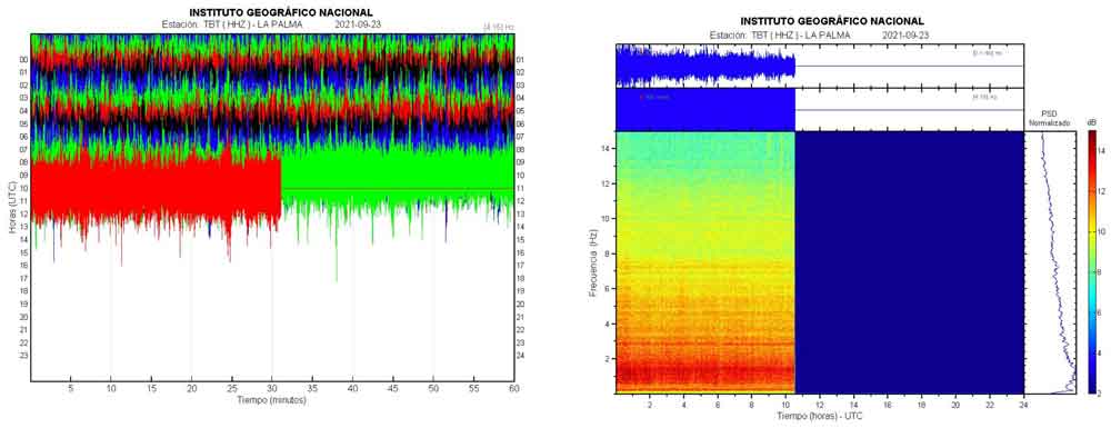
Deformation data show inflation overall is continuing although the trend has slowed down, or even decreased temporarily yesterday. Volcanic tremor remains high, but has been showing a slight decrease compared to the past days.
This suggests that the eruption might be becoming more stable, although it cannot be ruled out that new fissures open and new lava flows might appear.
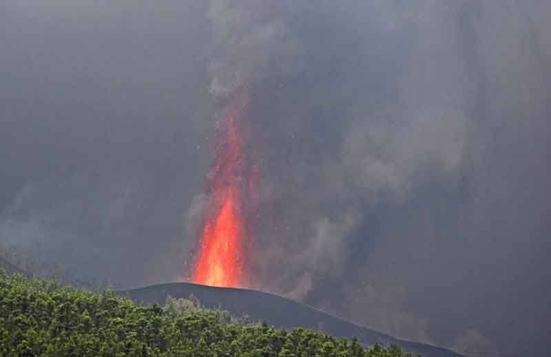
New vent near Tacande remains very active with lava fountains and active lava flows
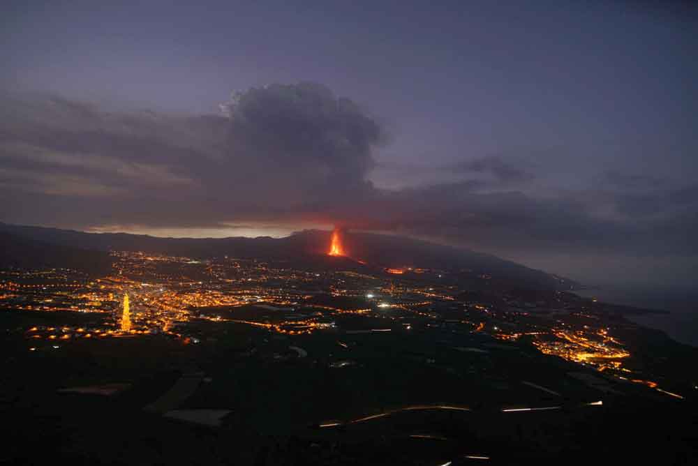
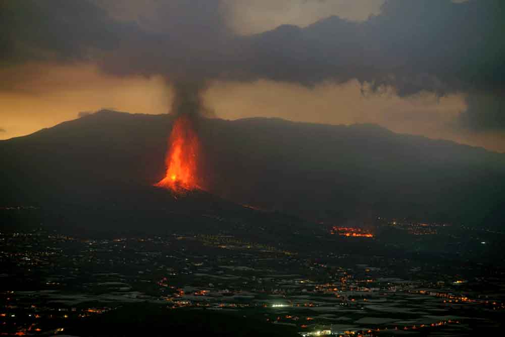
The eruption is now concentrated on the new fissure that opened yesterday.
This morning, we could see tall lava fountains continuing from it as well as a new lava flow that reached approx. 1-2 km length.
Cumbre Vieja volcano eruption, La Palma: lava flow map update
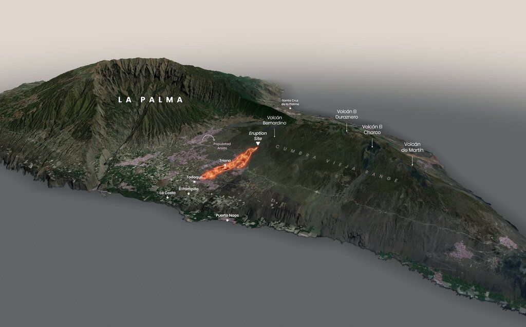
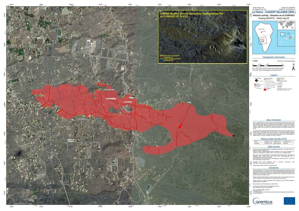
A new lava flow map of the current eruption site has been published and updated today.
The map depicts current lava flows that continue to keep active and slowly advancing towards the coast.
Link: Copernicus: Volcano eruption in La Palma, Spain
Cumbre Vieja volcano eruption, La Palma: eruption plumes travel further south Europe
The aerosol plumes from the eruptions continue to travel along the northern Africa and south Europe.
The Copernicus’s latest satellite-based measurements of SO2 concentrations in the atmosphere depict that they will reach Morocco, Tunisia, Algeria, Libya including a large part of Iberian Peninsula and Mediterranean coasts of France and Italy this Friday (24 September).
According to Windy.com’s visualization, the highest level of sulfur dioxide (SO2) emissions will likely occur in these areas.
A GIF animation depicts the volcano’s SO2 emissions traveling around the northern Africa and southern Europe (source: @m_parrington/twitter)
https://twitter.com/m_parrington/status/1440608903289397251?ref_src=twsrc%5Etfw
New vent opens, Tacande village evacuated
Activity continued to increase overall. During the course of the morning, two more fissures opened, one close to the original ones and another one further north of the existing vents, southeast of Tacande village, which was evacuated soon after. The opening of the vent followed rapid ground inflation in this area of 15 cm, according to unconfirmed information.
Most activity now seems to occur from the Tacande vent. It is well visible from the highway LP3 when going west after exiting the tunnel and attracts many tourists and locals alike to watch. Already, an elongated cinder cone has formed around it, and continuous lava fountains have been rising to approx. 2-300 m or more in height, producing a steam and ash plume that was rising approx. 2000 m and visible when we approached the island by airplane.
Our local correspondents who helped in recovery operations to save household items from threatened homes down from the active lava flow fronts, reported heavy ash fall in the downwind areas to the SW.
The lava flow fronts, often exceeding 10 m in height, slowed down further today but continue to widen; the largest one remains in the center of Todoque where more houses have fallen victim to the lava.
In total, the eruption has destroyed more than 320 homes and covered over 140 hectares of land by lava flows so far.


