 threadreaderapp.com
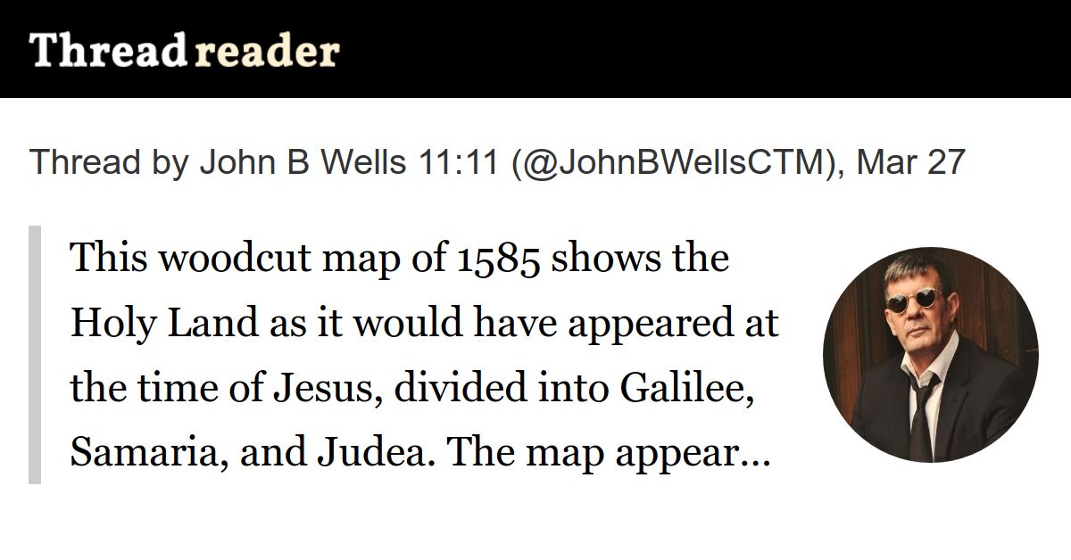
This woodcut map of 1585 shows the Holy Land as it would have appeared at the time of Jesus, divided into Galilee, Samaria, and Judea. The map appeared in the Itinerarium Sacrae Scripturae (Travel book through Holy Scripture) of Heinrich Bünting (1545-1606). Bünting studied theology at the University of Wittenberg in Germany and became a Protestant pastor and theologian.
Itinerarium Sacrae Scripturae was an immensely popular book in its day. It provided the most complete available summary of biblical geography and described the geography of the Holy Land by tracing the travels of major figures from the Old and New testaments.
whatreallyhappened.com/WRHARTICLES/ma…

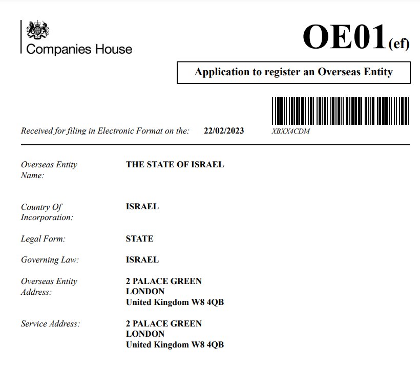
There is a difference between the Holy Land of the People of Israel and the State of Israel.


READ FULL ARTICLE HERE… (threadreaderapp.com)

Home | Caravan to Midnight (zutalk.com)


Be First to Comment